Map 3 ñ Staple Hill
The strange name 'Staple Hill' may derive from the old English word 'steap' meaning 'steep' but it is more likely to have described a long-lost pillar, post or standing stone ñ known as 'stapol,' (or staple).
Fishponds to Mangotsfield: 2 miles (3 knms)
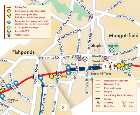
 1.
1. Although this picture shows sedimentary rock near Saltford Bridge, there is an exposed coalseam further along the Path on the Bath side of the Staple Hill tunnel. It lies about 50 metres from the entrance (on the right as you come from Bristol).
Its history begins 300 million years ago when the-land-that-was-to-become-Britain was drifting near the equator.
Here great areas of tropical forests fell, decayed and were covered with layers of silt by vast rivers. This was the beginning of the coal fields.
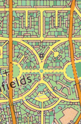
2. Detail from an old map showing symmetrical layout and green spaces. Hillfields Park was the first council housing estate in Bristol, begun in 1919. There was a need to provide 'homes for heroes' ñ the soldiers returning from World War I who looked forward to better lives.
The estate was spacious and the houses and gardens sizeable. This kind of development reflected a new social awareness that paved the way for the establishment of the welfare state.